Google-ISRO Partnership Provides 72-Hour Advance Warnings
India's National Disaster Management Authority launched an AI-powered flood forecasting system covering the entire Ganges River basin on April 1, 2026, developed in partnership between Google DeepMind, the Indian Space Research Organisation, and the Central Water Commission. The system provides location-specific flood predictions up to 72 hours in advance at 90-meter resolution, covering an area home to 500 million people across 11 states.
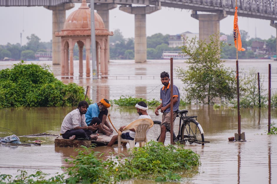
NDMA Chairman Lt. General Syed Ata Hasnain said the system represented "the most significant upgrade to India's flood preparedness in two decades." The Ganges basin experiences devastating floods annually, with the 2024 monsoon season causing $8.2 billion in damages and displacing 18 million people.
Technical Architecture
The system combines ISRO satellite data — including INSAT-3DR weather imagery and Cartosat-3 terrain mapping — with Google's AI flood forecasting models trained on 50 years of hydrological data from 4,800 river gauging stations. Machine learning algorithms process real-time rainfall data, soil moisture measurements, and upstream flow conditions to generate inundation maps showing predicted flood extent, depth, and timing.
Yossi Matias, vice president of engineering at Google, said the India deployment was "the largest-scale application of AI flood forecasting anywhere in the world." The system's accuracy in pilot testing across Bihar and Assam during the 2025 monsoon reached 88% for 48-hour predictions and 79% for 72-hour forecasts, compared to 55% for traditional hydrological models.
Warning Dissemination
Flood alerts are distributed through multiple channels: SMS to registered mobile numbers via India's Cell Broadcasting System, push notifications through the UMANG government services app, alerts to state disaster management authorities, and automated messaging to village-level panchayat leaders. The system reaches 340 million mobile devices in the basin, including basic feature phones through SMS.
Bihar Chief Minister Nitish Kumar, whose state suffers the worst annual flood damage, said the early warning system would "give families the time they need to move livestock, protect grain stores, and evacuate safely." Bihar's flood damage averaged $1.8 billion annually over the past five years.
Expansion Plans
The NDMA plans to extend the system to the Brahmaputra basin by the 2026 monsoon season and to all major river systems by 2028. The Central Water Commission is installing 1,200 additional automated gauging stations to improve data density in underserved catchments.
The World Meteorological Organization cited the India deployment as "a global benchmark for applying artificial intelligence to hydrometeorological disaster risk reduction" and encouraged other flood-prone nations including Bangladesh, Myanmar, and Cambodia to adopt similar approaches.